 SV WAKILI
Current Status
Where is the vessel?
SV WAKILI is currently in Near Port Of South Louisiana, based on AIS data received about 14h ago.
Latest AIS update:
Current position: 30.05179° N, 90.59050° W (Near Port Of South Louisiana)
Average speed (last 7 days): Loading…
Average speed (last 30 days): Loading…
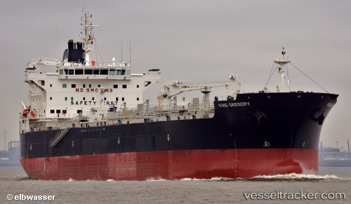
Vessel profile: SV WAKILI is a Chemical Oil Products Tanker with dimensions 183m x 32m.
This page combines live AIS, route history, probable destination signals, nearby traffic, and port activity for practical vessel monitoring.
The current position of vessel SV WAKILI is 30.05179 lat / -90.59050 lng. Updated: 2026-05-22 04:55:44 UTCNearest reference points:
- Near Port Of South Louisiana
- Near Good Hope
- Near Boutte
Currently sailing under the flag of Liberia ![]()
SV WAKILI built in 2012 year
Deadweight:
51441 tDetails:
Live Vessel SV WAKILI Analytics (details, animations, etc.)
Recent AIS points (UTC):
2026-05-22 01:02:00 UTC · 30.05178, -90.59050 · SOG 0 kn · COG 244°2026-05-22 02:35:23 UTC · 30.05179, -90.59048 · SOG 0 kn · COG -1°
2026-05-22 03:31:43 UTC · 30.05178, -90.59053 · SOG 0 kn · COG 244°
2026-05-22 04:55:44 UTC · 30.05179, -90.59050 · SOG 0 kn · COG 244°