 vesseltracker.com
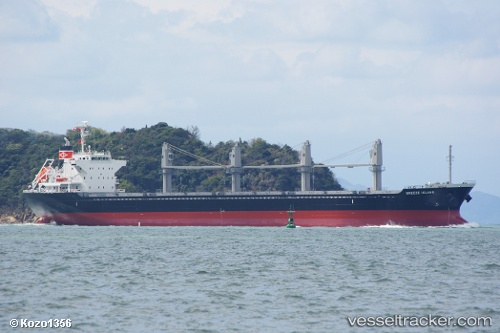
Stentor
Current StatusWhere is the vessel?
Stentor is currently in Near MOOLOOLABA, based on AIS data received less than 1h ago.
Latest AIS update:
Current position: 26.74712° S, 153.23663° E (Near MOOLOOLABA)
Average speed (last 7 days): Loading…
Average speed (last 30 days): Loading…
Vessel profile: Stentor is a Bulk Carrier with dimensions 27m x 170m.
This page combines live AIS, route history, probable destination signals, nearby traffic, and port activity for practical vessel monitoring.
The current position of vessel Stentor is -26.74712 lat / 153.23663 lng. Updated: 2026-05-13 22:20:20 UTCNearest reference points:
- Near Minyama
- Near MOOLOOLABA
- Near NOOSAVILLE
Details:
Live Vessel Stentor Analytics (details, animations, etc.)
Recent AIS points (UTC):
2026-05-13 19:25:51 UTC · -26.74770, 153.23643 · SOG 0.4 kn · COG 121°2026-05-13 20:02:04 UTC · -26.74791, 153.23619 · SOG 0.9 kn · COG 130°
2026-05-13 22:09:33 UTC · -26.74703, 153.23692 · SOG 0.6 kn · COG 142°
2026-05-13 22:20:20 UTC · -26.74712, 153.23663 · SOG 0.1 kn · COG 138°