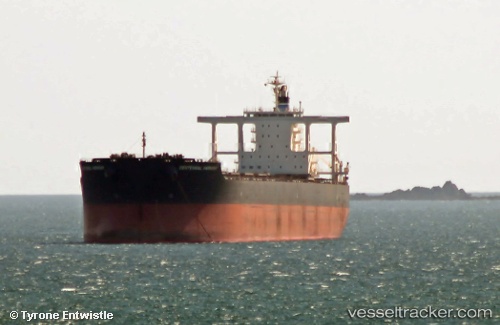
Centennial Harmony
Current StatusWhere is the vessel?
Centennial Harmony is currently in 64 nm SE of Kaohsiung, based on AIS data received about 16h ago.
Latest AIS update:
Current position: 22.09379° N, 121.36278° E (64 nm SE of Kaohsiung)
Average speed (last 7 days): Loading…
Average speed (last 30 days): Loading…
Vessel profile: Centennial Harmony is a Bulk Carrier with dimensions 45m x 292m.
This page combines live AIS, route history, probable destination signals, nearby traffic, and port activity for practical vessel monitoring.
The current position of vessel Centennial Harmony is 22.09379 lat / 121.36278 lng. Updated: 2026-05-25 07:54:42 UTCNearest reference points:
- 26 nm SE of Kaohsiung
- 11 nm SE of Kaohsiung
- Near Kaohsiung
Details:
Live Vessel Centennial Harmony Analytics (details, animations, etc.)
Recent AIS points (UTC):
2026-05-25 04:47:13 UTC · 21.41381, 121.15854 · SOG 12.6 kn · COG 15°2026-05-25 05:27:14 UTC · 21.55000, 121.20641 · SOG 12.9 kn · COG 10°
2026-05-25 07:28:54 UTC · 21.99569, 121.33614 · SOG 13.6 kn · COG 14°
2026-05-25 07:54:42 UTC · 22.09379, 121.36278 · SOG 14.4 kn · COG 13°