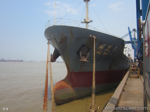
 Tong Mao 9
Current Status
Where is the vessel?
Tong Mao 9 is currently in 13 nm N of Taipei, based on AIS data received about 14h ago.
Latest AIS update:
Current position: 25.37400° N, 121.38465° E (13 nm N of Taipei)
Average speed (last 7 days): Loading…
Average speed (last 30 days): Loading…
Vessel profile: Tong Mao 9 is a General Cargo Ship with dimensions 112m x 17m.
This page combines live AIS, route history, probable destination signals, nearby traffic, and port activity for practical vessel monitoring.
The current position of vessel Tong Mao 9 is 25.37400 lat / 121.38465 lng. Updated: 2026-06-22 17:57:19 UTCNearest reference points:
- 11 nm NE of Bali
- Near Bali
- Near Sha-lun
Currently sailing under the flag of China ![]()
Details:
Live Vessel Tong Mao 9 Analytics (details, animations, etc.)
Recent AIS points (UTC):
2026-06-22 14:27:50 UTC · 25.21459, 120.79629 · SOG 10.4 kn · COG 70°2026-06-22 16:03:08 UTC · 25.29401, 121.08178 · SOG 10.3 kn · COG 75°
2026-06-22 16:11:48 UTC · 25.30097, 121.10788 · SOG 9.9 kn · COG 70°
2026-06-22 17:57:19 UTC · 25.37400, 121.38465 · SOG 8 kn · COG 69°