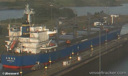
Anne
Current StatusWhere is the vessel?
Anne is currently in Near Tamatave, based on AIS data received about 15h ago.
Latest AIS update:
Current position: 18.11561° S, 49.41789° E (Near Tamatave)
Average speed (last 7 days): Loading…
Average speed (last 30 days): Loading…
Vessel profile: Anne is a Bulk Carrier with dimensions 32m x 190m.
This page combines live AIS, route history, probable destination signals, nearby traffic, and port activity for practical vessel monitoring.
The current position of vessel Anne is -18.11561 lat / 49.41789 lng. Updated: 2026-07-03 16:15:11 UTCDetails:
Live Vessel Anne Analytics (details, animations, etc.)
Recent AIS points (UTC):
2026-07-03 14:00:11 UTC · -18.11564, 49.41760 · SOG 0.1 kn · COG 134°2026-07-03 14:24:11 UTC · -18.11598, 49.41743 · SOG 0.2 kn · COG 121°
2026-07-03 16:06:11 UTC · -18.11540, 49.41801 · SOG 0.1 kn · COG 152°
2026-07-03 16:15:11 UTC · -18.11561, 49.41789 · SOG 0.3 kn · COG 148°