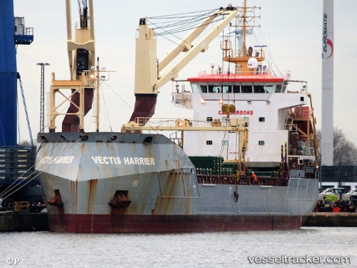
 Vectis Harrier
Current Status
Where is the vessel?
Vectis Harrier is currently in Near Luanda, based on AIS data received about 120d ago.
Latest AIS update:
Current position: 8.75177° S, 13.25328° E (Near Luanda)
Average speed (last 7 days): Loading…
Average speed (last 30 days): Loading…
Vessel profile: Vectis Harrier is a Multi Purpose Carrier with dimensions 110m x 18m.
This page combines live AIS, route history, probable destination signals, nearby traffic, and port activity for practical vessel monitoring.
The current position of vessel Vectis Harrier is -8.75177 lat / 13.25328 lng. Updated: 2026-01-21 08:58:19 UTCNearest reference points:
- Near Luanda
- Near Greater Plutonio
Currently sailing under the flag of United Kingdom ![]()
Vectis Harrier built in 2012 year
Deadweight:
8556 tDetails:
Live Vessel Vectis Harrier Analytics (details, animations, etc.)
Recent AIS points (UTC):
2026-01-21 08:58:19 UTC · -8.75177, 13.25328 · SOG 0 kn · COG 79°