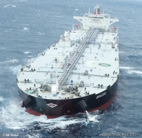
Brazos
Current StatusWhere is the vessel?
Brazos is currently in 26 nm SE of LA PALOMA, based on AIS data received about 14h ago.
Latest AIS update:
Current position: 35.04281° S, 53.90881° W (26 nm SE of LA PALOMA)
Average speed (last 7 days): Loading…
Average speed (last 30 days): Loading…
Vessel profile: Brazos is a Crude Oil Tanker with dimensions 48m x 274m.
This page combines live AIS, route history, probable destination signals, nearby traffic, and port activity for practical vessel monitoring.
The current position of vessel Brazos is -35.04281 lat / -53.90881 lng. Updated: 2026-07-09 00:26:05 UTCNearest reference points:
- 21 nm E of PUNTA DEL ESTE
- 75 nm SE of LA PALOMA
- 55 nm SE of Chui
Details:
Live Vessel Brazos Analytics (details, animations, etc.)
Recent AIS points (UTC):
2026-07-08 20:44:28 UTC · -35.04033, -53.90832 · SOG 0 kn · COG 265°2026-07-08 22:41:17 UTC · -35.04272, -53.90876 · SOG 0.1 kn · COG 314°
2026-07-08 23:29:07 UTC · -35.04265, -53.90874 · SOG 0.1 kn · COG 313°
2026-07-09 00:26:05 UTC · -35.04281, -53.90881 · SOG 0 kn · COG 315°