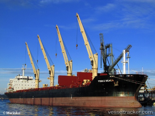
 PEBBLE BEACH
Current Status
Where is the vessel?
PEBBLE BEACH is currently in 69 nm SW of Tsiombe, based on AIS data received about 14h ago.
Latest AIS update:
Current position: 26.33325° S, 44.91356° E (69 nm SW of Tsiombe)
Average speed (last 7 days): Loading…
Average speed (last 30 days): Loading…
Vessel profile: PEBBLE BEACH is a Bulk Carrier with dimensions m x m.
This page combines live AIS, route history, probable destination signals, nearby traffic, and port activity for practical vessel monitoring.
The current position of vessel PEBBLE BEACH is -26.33325 lat / 44.91356 lng. Updated: 2026-05-21 16:01:06 UTCNearest reference points:
- 70 nm SW of Tsiombe
- 106 nm S of Tsiombe
- 148 nm SW of Tsiombe
Currently sailing under the flag of Antigua and Barbuda ![]()
Details:
Live Vessel PEBBLE BEACH Analytics (details, animations, etc.)
Recent AIS points (UTC):
2026-05-21 13:29:42 UTC · -26.50171, 45.45379 · SOG 12.3 kn · COG 289°2026-05-21 13:48:58 UTC · -26.47773, 45.38545 · SOG 12.4 kn · COG 290°
2026-05-21 15:26:18 UTC · -26.37361, 45.02770 · SOG 11.6 kn · COG 288°
2026-05-21 16:01:06 UTC · -26.33325, 44.91356 · SOG 11 kn · COG 291°