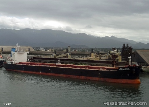
Sea Harmony
Current StatusWhere is the vessel?
Sea Harmony is currently in 252 nm E of Diego Garcia, based on AIS data received about 14h ago.
Latest AIS update:
Current position: 6.31055° S, 76.56502° E (252 nm E of Diego Garcia)
Average speed (last 7 days): Loading…
Average speed (last 30 days): Loading…
Vessel profile: Sea Harmony is a Bulk Carrier with dimensions 32m x 229m.
This page combines live AIS, route history, probable destination signals, nearby traffic, and port activity for practical vessel monitoring.
The current position of vessel Sea Harmony is -6.31055 lat / 76.56502 lng. Updated: 2026-05-19 00:00:34 UTCNearest reference points:
- 208 nm E of Diego Garcia
- 284 nm E of Diego Garcia
- Open sea, approx. 400 nm off the nearest listed port
Details:
Live Vessel Sea Harmony Analytics (details, animations, etc.)
Recent AIS points (UTC):
2026-05-18 20:05:19 UTC · -6.64748, 76.07188 · SOG 8.8 kn · COG 58°2026-05-18 21:48:22 UTC · -6.50425, 76.28766 · SOG 9 kn · COG 53°
2026-05-18 22:06:34 UTC · -6.47832, 76.32477 · SOG 9 kn · COG 54°
2026-05-19 00:00:34 UTC · -6.31055, 76.56502 · SOG 9.4 kn · COG 56°