 Red
Red
Current Status
Where is the vessel?
Red is currently in Near Santo Estevao, based on AIS data received about 14h ago.
Latest AIS update:
Current position: 12.75339° S, 38.62517° W (Near Santo Estevao)
Average speed (last 7 days): Loading…
Average speed (last 30 days): Loading…
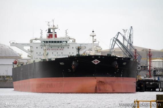
Vessel profile: Red is a Crude Oil Tanker with dimensions 274m x 48m.
This page combines live AIS, route history, probable destination signals, nearby traffic, and port activity for practical vessel monitoring.
The current position of vessel Red is -12.75339 lat / -38.62517 lng. Updated: 2026-05-20 13:53:03 UTCNearest reference points:
- Near Aracaju
- Near Barra dos Coqueiros
Currently sailing under the flag of Marshall Is ![]()
Red built in 2012 year
Deadweight:
159068 tDetails:
Live Vessel Red Analytics (details, animations, etc.)
Recent AIS points (UTC):
2026-05-20 11:06:23 UTC · -12.75341, -38.62515 · SOG 0 kn · COG 119°2026-05-20 12:00:23 UTC · -12.75340, -38.62513 · SOG 0.1 kn · COG 119°
2026-05-20 13:43:56 UTC · -12.75340, -38.62512 · SOG 0 kn · COG 119°
2026-05-20 13:53:03 UTC · -12.75339, -38.62517 · SOG 0 kn · COG 119°