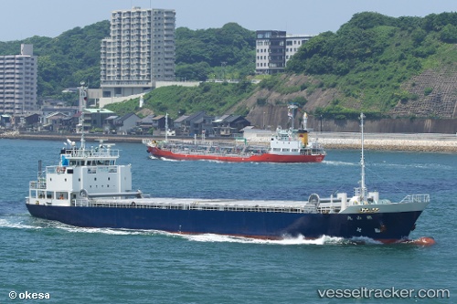
Tetsuzan Maru
Current StatusWhere is the vessel?
Tetsuzan Maru is currently in Near YAWATA, based on AIS data received about 14h ago.
Latest AIS update:
Current position: 33.87415° N, 130.80412° E (Near YAWATA)
Average speed (last 7 days): Loading…
Average speed (last 30 days): Loading…
Vessel profile: Tetsuzan Maru is a General Cargo Ship with dimensions 12m x 72m.
This page combines live AIS, route history, probable destination signals, nearby traffic, and port activity for practical vessel monitoring.
The current position of vessel Tetsuzan Maru is 33.87415 lat / 130.80412 lng. Updated: 2026-05-19 03:56:14 UTCNearest reference points:
- Near KITAKYUSHU
- Near Kokura
- Near Kanmon
Details:
Live Vessel Tetsuzan Maru Analytics (details, animations, etc.)
Recent AIS points (UTC):
2026-05-18 23:22:53 UTC · 33.87458, 130.80351 · SOG 0.4 kn · COG -1°2026-05-19 01:45:14 UTC · 33.87513, 130.80373 · SOG 0 kn · COG -1°
2026-05-19 01:59:53 UTC · 33.87488, 130.80417 · SOG 0 kn · COG -1°
2026-05-19 03:56:14 UTC · 33.87415, 130.80412 · SOG 0.1 kn · COG -1°