Galateia
Current StatusWhere is the vessel?
Galateia is currently in 89 nm NE of Sapiranga, based on AIS data received about 15h ago.
Latest AIS update:
Current position: 28.35351° S, 24.20953° W (89 nm NE of Sapiranga)
Average speed (last 7 days): Loading…
Average speed (last 30 days): Loading…
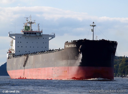
Vessel profile: Galateia is a Bulk Carrier with dimensions 32m x 229m.
This page combines live AIS, route history, probable destination signals, nearby traffic, and port activity for practical vessel monitoring.
The current position of vessel Galateia is -28.35351 lat / -24.20953 lng. Updated: 2026-05-20 22:36:04 UTCDetails:
Live Vessel Galateia Analytics (details, animations, etc.)
Recent AIS points (UTC):
2026-05-20 17:49:35 UTC · -28.43606, -23.34239 · SOG 9.5 kn · COG 274°2026-05-20 19:31:06 UTC · -28.41005, -23.64691 · SOG 9.7 kn · COG 275°
2026-05-20 21:27:45 UTC · -28.37255, -24.00231 · SOG 9.8 kn · COG 274°
2026-05-20 22:36:04 UTC · -28.35351, -24.20953 · SOG 9.8 kn · COG 274°