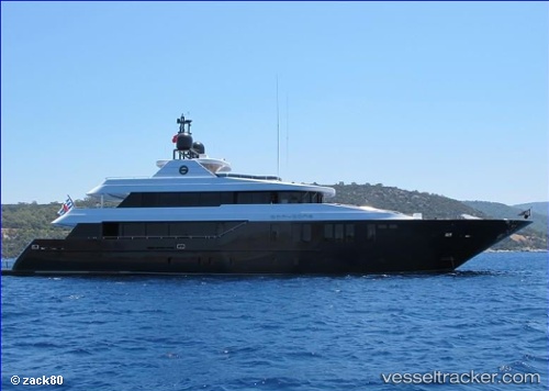
 THANUJA
Current Status
Where is the vessel?
THANUJA is currently in Near Palma, based on AIS data received about 14h ago.
Latest AIS update:
Current position: 39.55723° N, 2.62820° E (Near Palma)
Average speed (last 7 days): Loading…
Average speed (last 30 days): Loading…
Vessel profile: THANUJA is a Yacht with dimensions m x m.
This page combines live AIS, route history, probable destination signals, nearby traffic, and port activity for practical vessel monitoring.
The current position of vessel THANUJA is 39.55723 lat / 2.62820 lng. Updated: 2026-05-20 13:53:15 UTCNearest reference points:
- Near Palma
- Near PALMA DE MALLORCA
- Near PORTALS NOUS
Details:
Live Vessel THANUJA Analytics (details, animations, etc.)
Recent AIS points (UTC):
2026-05-20 10:26:13 UTC · 39.55721, 2.62817 · SOG 0 kn · COG 0°2026-05-20 11:47:36 UTC · 39.55725, 2.62820 · SOG 0 kn · COG 0°
2026-05-20 13:25:28 UTC · 39.55667, 2.62667 · SOG 0 kn · COG -1°
2026-05-20 13:53:15 UTC · 39.55723, 2.62820 · SOG 0 kn · COG 0°