 Dong Gui 9
Current Status
Where is the vessel?
Dong Gui 9 is currently in Near HUIZHOU, based on AIS data received about 14h ago.
Latest AIS update:
Current position: 22.68855° N, 114.57834° E (Near HUIZHOU)
Average speed (last 7 days): Loading…
Average speed (last 30 days): Loading…
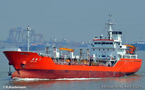
Vessel profile: Dong Gui 9 is a Chemical Oil Products Tanker with dimensions 97m x 97m.
This page combines live AIS, route history, probable destination signals, nearby traffic, and port activity for practical vessel monitoring.
The current position of vessel Dong Gui 9 is 22.68855 lat / 114.57834 lng. Updated: 2026-06-29 16:31:22 UTCNearest reference points:
- Near HUIZHOU
- Near Dayawan
- Near Pinghai
Currently sailing under the flag of China ![]()
Details:
Live Vessel Dong Gui 9 Analytics (details, animations, etc.)
Recent AIS points (UTC):
2026-06-29 13:19:20 UTC · 22.68854, 114.57829 · SOG 0 kn · COG 177°2026-06-29 14:13:21 UTC · 22.68855, 114.57832 · SOG 0 kn · COG 177°
2026-06-29 15:31:21 UTC · 22.68853, 114.57835 · SOG 0 kn · COG 177°
2026-06-29 16:31:22 UTC · 22.68855, 114.57834 · SOG 0 kn · COG 177°