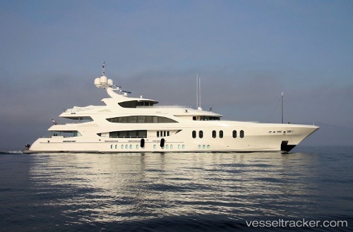
 Liberty
Current Status
Where is the vessel?
Liberty is currently in Near Rejected, based on AIS data received about 14h ago.
Latest AIS update:
Current position: 37.31495° N, 0.83661° W (Near Rejected)
Average speed (last 7 days): Loading…
Average speed (last 30 days): Loading…
Vessel profile: Liberty is a Service Ship with dimensions 57m x 10m.
This page combines live AIS, route history, probable destination signals, nearby traffic, and port activity for practical vessel monitoring.
The current position of vessel Liberty is 37.31495 lat / -0.83661 lng. Updated: 2026-05-20 13:39:27 UTCNearest reference points:
- 20 nm S of Rejected
- 23 nm S of Rejected
- Near ESCOMBRERAS
Currently sailing under the flag of Cayman Is ![]()
Details:
Live Vessel Liberty Analytics (details, animations, etc.)
Recent AIS points (UTC):
2026-05-20 10:33:34 UTC · 36.82860, -1.51131 · SOG 13.9 kn · COG 48°2026-05-20 11:38:00 UTC · 37.00160, -1.27866 · SOG 14.3 kn · COG 47°
2026-05-20 13:22:36 UTC · 37.27222, -0.89767 · SOG 13.9 kn · COG 48°
2026-05-20 13:39:27 UTC · 37.31495, -0.83661 · SOG 13.8 kn · COG 48°