 vesseltracker.com
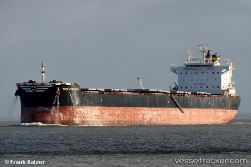
 Ines Corrado
Current Status
Where is the vessel?
Ines Corrado is currently in 120 nm NW of Villa Elisa, based on AIS data received about 14h ago.
Latest AIS update:
Current position: 26.73333° N, 59.22833° W (120 nm NW of Villa Elisa)
Average speed (last 7 days): Loading…
Average speed (last 30 days): Loading…
Vessel profile: Ines Corrado is a Bulk Carrier with dimensions 229m x 229m.
This page combines live AIS, route history, probable destination signals, nearby traffic, and port activity for practical vessel monitoring.
The current position of vessel Ines Corrado is 26.73333 lat / -59.22833 lng. Updated: 2026-05-18 13:35:23 UTCCurrently sailing under the flag of Bahamas ![]()
Ines Corrado built in 2012 year
Deadweight:
81272 tDetails:
Live Vessel Ines Corrado Analytics (details, animations, etc.)
Recent AIS points (UTC):
2026-05-18 10:26:26 UTC · 27.18167, -58.73333 · SOG 11 kn · COG -1°2026-05-18 12:14:23 UTC · 26.92333, -59.01500 · SOG 12 kn · COG -1°
2026-05-18 13:08:25 UTC · 26.79667, -59.15833 · SOG 11 kn · COG -1°
2026-05-18 13:35:23 UTC · 26.73333, -59.22833 · SOG 11 kn · COG -1°