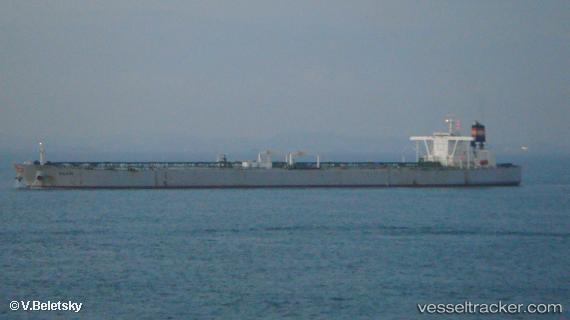
 MAXIM
MAXIM
Current Status
Where is the vessel?
MAXIM is currently in Open sea, approx. 461 nm off the nearest listed port, based on AIS data received about 14h ago.
Latest AIS update:
Current position: 33.13333° S, 7.40833° E (Open sea, approx. 461 nm off the nearest listed port)
Average speed (last 7 days): Loading…
Average speed (last 30 days): Loading…
Vessel profile: MAXIM is a Crude Oil Tanker with dimensions 330m x 330m.
This page combines live AIS, route history, probable destination signals, nearby traffic, and port activity for practical vessel monitoring.
The current position of vessel MAXIM is -33.13333 lat / 7.40833 lng. Updated: 2026-07-15 13:11:26 UTCNearest reference points:
- Open sea, approx. 461 nm off the nearest listed port
- Open sea, approx. 464 nm off the nearest listed port
- Open sea, approx. 459 nm off the nearest listed port
Currently sailing under the flag of Marshall Islands ![]()
MAXIM built in 2011 year
Deadweight:
296887 tDetails:
Live Vessel MAXIM Analytics (details, animations, etc.)
Recent AIS points (UTC):
2026-07-15 11:09:27 UTC · -33.19730, 7.40644 · SOG 2.4 kn · COG 315°2026-07-15 12:20:25 UTC · -33.16000, 7.40667 · SOG 1 kn · COG -1°
2026-07-15 13:11:26 UTC · -33.13333, 7.40833 · SOG 1 kn · COG -1°
2026-07-15 13:11:26 UTC · -33.13333, 7.40833 · SOG 1 kn · COG -1°