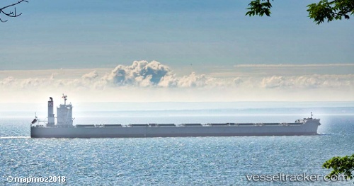
Cape Sunrise
Current StatusWhere is the vessel?
Cape Sunrise is currently in 58 nm E of Fort Dauphin, based on AIS data received about 14h ago.
Latest AIS update:
Current position: 24.72691° S, 48.03397° E (58 nm E of Fort Dauphin)
Average speed (last 7 days): Loading…
Average speed (last 30 days): Loading…
Vessel profile: Cape Sunrise is a Bulk Carrier with dimensions 45m x 292m.
This page combines live AIS, route history, probable destination signals, nearby traffic, and port activity for practical vessel monitoring.
The current position of vessel Cape Sunrise is -24.72691 lat / 48.03397 lng. Updated: 2026-05-20 17:22:39 UTCNearest reference points:
- 106 nm S of Tsiombe
Details:
Live Vessel Cape Sunrise Analytics (details, animations, etc.)
Recent AIS points (UTC):
2026-05-20 14:12:33 UTC · -24.23054, 48.55051 · SOG 12.7 kn · COG 222°2026-05-20 15:22:42 UTC · -24.41113, 48.36400 · SOG 12.8 kn · COG 222°
2026-05-20 16:54:30 UTC · -24.65214, 48.11358 · SOG 13 kn · COG 222°
2026-05-20 17:22:39 UTC · -24.72691, 48.03397 · SOG 13.3 kn · COG 222°