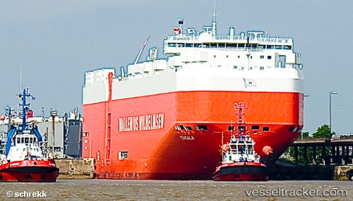
Tongala
Current StatusWhere is the vessel?
Tongala is currently in Near Mipo/Ulsan, based on AIS data received about 14h ago.
Latest AIS update:
Current position: 35.51730° N, 129.37800° E (Near Mipo/Ulsan)
Average speed (last 7 days): Loading…
Average speed (last 30 days): Loading…
Vessel profile: Tongala is a Vehicles Carrier with dimensions 32m x 200m.
This page combines live AIS, route history, probable destination signals, nearby traffic, and port activity for practical vessel monitoring.
The current position of vessel Tongala is 35.5173 lat / 129.378 lng. Updated: 2026-05-20 15:46:25 UTCNearest reference points:
- Near Ulsan
- Near Ilsan
- Near ONSAN
Details:
Live Vessel Tongala Analytics (details, animations, etc.)
Recent AIS points (UTC):
2026-05-20 11:22:44 UTC · 35.51730, 129.37800 · SOG 0 kn · COG -1°2026-05-20 13:22:26 UTC · 35.51730, 129.37800 · SOG 0 kn · COG 97°
2026-05-20 13:58:25 UTC · 35.51730, 129.37800 · SOG 0 kn · COG 97°
2026-05-20 15:46:25 UTC · 35.51730, 129.37800 · SOG 0 kn · COG 97°