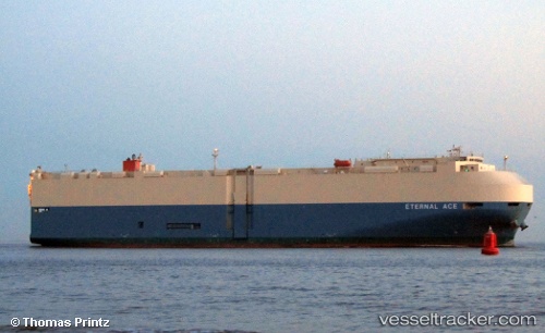
 ETERNAL ACE
Current Status
Where is the vessel?
ETERNAL ACE is currently in Near Reynella, based on AIS data received about 15h ago.
Latest AIS update:
Current position: 36.19263° S, 138.50063° E (Near Reynella)
Average speed (last 7 days): Loading…
Average speed (last 30 days): Loading…
Vessel profile: ETERNAL ACE is a Vehicles Carrier with dimensions 32m x 200m.
This page combines live AIS, route history, probable destination signals, nearby traffic, and port activity for practical vessel monitoring.
The current position of vessel ETERNAL ACE is -36.19263 lat / 138.50063 lng. Updated: 2026-05-20 07:51:13 UTCNearest reference points:
- Near Port Adelaide
- Near Gillman
- Near North Haven
Currently sailing under the flag of Japan ![]()
ETERNAL ACE built in 2011 year
Deadweight:
18418 tDetails:
Live Vessel ETERNAL ACE Analytics (details, animations, etc.)
Recent AIS points (UTC):
2026-05-20 04:14:50 UTC · -35.31488, 138.09058 · SOG 17.6 kn · COG 203°2026-05-20 05:38:20 UTC · -35.67562, 138.06036 · SOG 15.5 kn · COG 142°
2026-05-20 07:51:02 UTC · -36.19175, 138.50002 · SOG 18 kn · COG 152°
2026-05-20 07:51:13 UTC · -36.19263, 138.50063 · SOG 18 kn · COG 152°