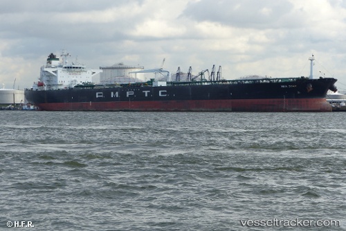
Sea Star
Current StatusWhere is the vessel?
Sea Star is currently in Near AL DUQM, based on AIS data received about 14h ago.
Latest AIS update:
Current position: 19.68240° N, 57.86755° E (Near AL DUQM)
Average speed (last 7 days): Loading…
Average speed (last 30 days): Loading…
Vessel profile: Sea Star is a Crude Oil Tanker with dimensions 44m x 249m.
This page combines live AIS, route history, probable destination signals, nearby traffic, and port activity for practical vessel monitoring.
The current position of vessel Sea Star is 19.68240 lat / 57.86755 lng. Updated: 2026-07-02 15:49:09 UTCNearest reference points:
- Near AL DUQM
- Near Duqm
- 39 nm SE of Pizhou
Details:
Live Vessel Sea Star Analytics (details, animations, etc.)
Recent AIS points (UTC):
2026-07-02 13:17:59 UTC · 19.68256, 57.86733 · SOG 0 kn · COG -1°2026-07-02 13:42:52 UTC · 19.68237, 57.86772 · SOG 0.4 kn · COG -1°
2026-07-02 15:49:09 UTC · 19.68240, 57.86755 · SOG 0.5 kn · COG -1°
2026-07-02 15:49:09 UTC · 19.68240, 57.86755 · SOG 0.5 kn · COG -1°