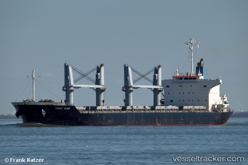
 TRUST STAR
Current Status
Where is the vessel?
TRUST STAR is currently in 325 nm E of Saint George, based on AIS data received about 15h ago.
Latest AIS update:
Current position: 32.80831° N, 58.27925° W (325 nm E of Saint George)
Average speed (last 7 days): Loading…
Average speed (last 30 days): Loading…
Vessel profile: TRUST STAR is a Bulk Carrier with dimensions m x m.
This page combines live AIS, route history, probable destination signals, nearby traffic, and port activity for practical vessel monitoring.
The current position of vessel TRUST STAR is 32.80831 lat / -58.27925 lng. Updated: 2026-05-19 23:28:14 UTCNearest reference points:
- 311 nm E of Saint George
- Open sea, approx. 401 nm off the nearest listed port
- Open sea, approx. 403 nm off the nearest listed port
Currently sailing under the flag of Malta ![]()
Details:
Live Vessel TRUST STAR Analytics (details, animations, etc.)
Recent AIS points (UTC):
2026-05-19 19:50:55 UTC · 33.06340, -57.49801 · SOG 11.5 kn · COG 252°2026-05-19 21:47:55 UTC · 32.92633, -57.91892 · SOG 11.9 kn · COG 241°
2026-05-19 22:21:55 UTC · 32.87990, -58.03896 · SOG 11.7 kn · COG 247°
2026-05-19 23:28:14 UTC · 32.80831, -58.27925 · SOG 11.4 kn · COG 243°