 vesseltracker.com
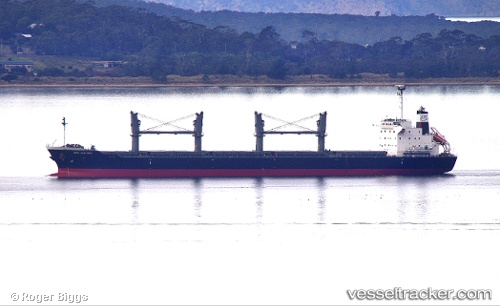
 R SKYWALKER
Current Status
Where is the vessel?
R SKYWALKER is currently in 261 nm SW of Southampton, based on AIS data received about 1h ago.
Latest AIS update:
Current position: 28.35553° N, 67.08954° W (261 nm SW of Southampton)
Average speed (last 7 days): Loading…
Average speed (last 30 days): Loading…
Vessel profile: R SKYWALKER is a Bulk Carrier with dimensions 29m x 177m.
This page combines live AIS, route history, probable destination signals, nearby traffic, and port activity for practical vessel monitoring.
The current position of vessel R SKYWALKER is 28.35553 lat / -67.08954 lng. Updated: 2026-05-13 21:34:57 UTCCurrently sailing under the flag of Liberia ![]()
R SKYWALKER built in 2013 year
Deadweight:
36332 tDetails:
Live Vessel R SKYWALKER Analytics (details, animations, etc.)
Recent AIS points (UTC):
2026-05-13 17:17:35 UTC · 28.13606, -68.12376 · SOG 12.9 kn · COG 79°2026-05-13 19:28:45 UTC · 28.25176, -67.59720 · SOG 13.3 kn · COG 80°
2026-05-13 19:50:02 UTC · 28.27122, -67.51098 · SOG 13.3 kn · COG 80°
2026-05-13 21:34:57 UTC · 28.35553, -67.08954 · SOG 12.7 kn · COG 83°