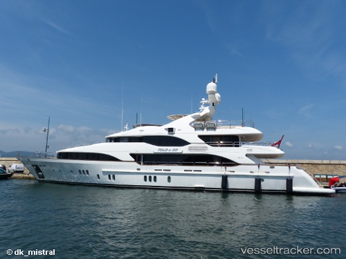
Moka
Current StatusWhere is the vessel?
Moka is currently in Near Port Everglades, based on AIS data received about 15h ago.
Latest AIS update:
Current position: 26.09786° N, 80.16367° W (Near Port Everglades)
Average speed (last 7 days): Loading…
Average speed (last 30 days): Loading…
Vessel profile: Moka is a Service Ship with dimensions 10m x 45m.
This page combines live AIS, route history, probable destination signals, nearby traffic, and port activity for practical vessel monitoring.
The current position of vessel Moka is 26.09786 lat / -80.16367 lng. Updated: 2026-05-21 00:12:35 UTCNearest reference points:
- Near Port Everglades
- Near Fort Lauderdale
- Near Dania Beach
Details:
Live Vessel Moka Analytics (details, animations, etc.)
Recent AIS points (UTC):
2026-05-20 19:10:13 UTC · 26.09785, -80.16357 · SOG 0 kn · COG 356°2026-05-20 21:57:37 UTC · 26.09787, -80.16364 · SOG 0 kn · COG 356°
2026-05-20 23:12:09 UTC · 26.09789, -80.16361 · SOG 0 kn · COG -1°
2026-05-21 00:12:35 UTC · 26.09786, -80.16367 · SOG 0 kn · COG 356°