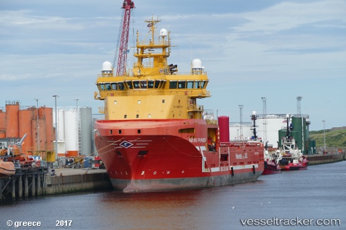
 VIKING PRINCESS
Current Status
Where is the vessel?
VIKING PRINCESS is currently in 32 nm NW of MAILIAO, based on AIS data received about 14h ago.
Latest AIS update:
Current position: 24.21364° N, 119.81045° E (32 nm NW of MAILIAO)
Average speed (last 7 days): Loading…
Average speed (last 30 days): Loading…
Vessel profile: VIKING PRINCESS is a Multi Purpose Offshore Vessel with dimensions m x m.
This page combines live AIS, route history, probable destination signals, nearby traffic, and port activity for practical vessel monitoring.
The current position of vessel VIKING PRINCESS is 24.21364 lat / 119.81045 lng. Updated: 2026-05-22 10:13:42 UTCNearest reference points:
- 13 nm N of MAGONG
- Near MAILIAO
- 19 nm NE of Putian
Currently sailing under the flag of Norway ![]()
Details:
Live Vessel VIKING PRINCESS Analytics (details, animations, etc.)
Recent AIS points (UTC):
2026-05-22 05:30:39 UTC · 24.21393, 119.81020 · SOG 0 kn · COG 29°2026-05-22 07:40:02 UTC · 24.21393, 119.81018 · SOG 0 kn · COG 29°
2026-05-22 08:21:42 UTC · 24.21394, 119.81018 · SOG 0 kn · COG 29°
2026-05-22 10:13:42 UTC · 24.21364, 119.81045 · SOG 0 kn · COG 29°