.
Vessel photo of Samjohn Vision (IMO 9612076) vesseltracker.com

MH flag Samjohn Vision

Vessel type: Bulk Carrier | IMO: 9612076 | MMSI: MMSI: 538007464
Call sign: V7PA7 | Dimensions: 300 m x 300 m
Current Status

Where is the vessel?

Samjohn Vision is currently in 138 nm NW of Ile Desroches, based on AIS data received less than 1h ago.

Latest AIS update:

Current position: 4.61559° S, 51.63853° E (138 nm NW of Ile Desroches)

Average speed (last 7 days): Loading…

Average speed (last 30 days): Loading…

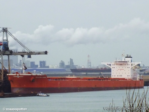
Vessel profile: Samjohn Vision is a Bulk Carrier with dimensions 300m x 300m.

This page combines live AIS, route history, probable destination signals, nearby traffic, and port activity for practical vessel monitoring.

The current position of vessel Samjohn Vision is -4.61559 lat / 51.63853 lng. Updated: 2026-04-27 12:52:34 UTC
Nearest reference points:
  • 118 nm W of Ile Desroches
  • Near Ile Desroches
  • 219 nm W of Ile Desroches

Currently sailing under the flag of Marshall Is MH flag

Samjohn Vision built in 2012 year

Deadweight:
206562 t

Details:

Live Vessel Samjohn Vision Analytics (details, animations, etc.)


Recent AIS points (UTC):
2026-04-27 10:00:14 UTC · -4.24489, 51.96885 · SOG 10.4 kn · COG 222°
2026-04-27 10:53:24 UTC · -4.35833, 51.86667 · SOG 10 kn · COG -1°
2026-04-27 11:54:16 UTC · -4.48687, 51.75193 · SOG 10.3 kn · COG 220°
2026-04-27 12:52:34 UTC · -4.61559, 51.63853 · SOG 10.6 kn · COG 220°

Track of the vessel in the last 60 days


UTC: --
Start: -- Track timeline (UTC) End: --
Encountered: --


Link to the map:


Find another ship

Samjohn_Vision (538007464) last ports (portcalls and passsages)

JURONG ISLAND | 2025-07-23 20:47:58
PULAU SAMBU | 2025-07-23 18:45:32
TANAH MERAH | 2025-07-23 02:13:39
PENGERANG | 2025-07-23 00:39:58
CAOFEIDIAN | 2025-07-09 02:41:07
TANAH MERAH | 2025-06-27 03:19:18
BATU AMPAR | 2025-06-27 01:47:59
PULAU SAMBU | 2025-06-27 00:41:29
Cape Of Good Hope | 2025-06-04 08:12:34
Cape Of Good Hope | 2025-04-24 01:45:28
BATU AMPAR | 2025-04-03 14:40:27
TANAH MERAH | 2025-04-02 14:42:09
PENGERANG | 2025-04-02 13:31:29
PENGERANG | 2025-03-10 21:15:07
PULAU SAMBU | 2025-03-10 19:49:10
BUKOM ISLAND | 2025-03-10 18:57:48
JURONG ISLAND | 2025-02-08 03:02:33
BUKOM ISLAND | 2025-02-08 02:22:46
PULAU SAMBU | 2025-02-06 22:46:58
BATU AMPAR | 2025-02-06 22:04:11
TANAH MERAH | 2025-02-06 21:03:13
PENGERANG | 2025-02-06 18:39:40
Taku Bar | 2025-01-27 04:02:44
Ta-Ku | 2025-01-27 01:36:34
Ta-Ku | 2025-01-23 01:35:33
Dagu Bar | 2025-01-22 23:00:11
Taku Bar | 2025-01-22 22:13:55
TANAH MERAH | 2025-01-09 12:26:35
BATU AMPAR | 2025-01-09 12:07:56
BUKOM ISLAND | 2025-01-09 10:51:43
Singapore | 2024-10-19 11:57:54
Rizhao | 2024-10-03 04:39:24
Singapore | 2024-07-11 22:16:23
Port Headland | 2024-06-14 16:30:37
Selat Lombok | 2024-06-08 17:29:23
Selat Lombok | 2024-05-17 05:27:40
Port Headland | 2024-05-13 10:42:43
Port Headland | 2024-05-04 09:40:03
Selat Lombok | 2024-04-28 23:41:34
Taku Bar | 2024-04-15 12:23:50
Selat Lombok | 2024-04-02 21:22:48
Port Headland | 2024-03-29 10:27:09
Qingdao | 2024-02-27 08:43:19
Qingdao | 2024-02-23 08:17:24
Singapore | 2024-02-10 07:54:23
Sambu | 2023-11-18 22:34:53
Singapore | 2023-11-17 00:15:26
Singapore | 2023-07-31 08:12:28
Singapore | 2023-07-04 05:52:35
Singapore | 2023-04-22 00:42:05
Taku Bar | 2023-04-10 13:27:31
Dagu Bar | 2023-04-10 13:03:05
Port Headland | 2023-03-19 11:29:14
Selat Lombok | 2023-03-12 05:02:18
Wusong | 2023-03-02 03:00:51
Taicang | 2023-02-26 11:17:26
Port Headland | 2022-11-07 20:12:58
Singapore | 2022-07-21 16:46:14
Wusong | 2022-07-10 01:05:20
Selat Lombok | 2022-06-25 13:58:00
Port Headland | 2022-06-21 04:40:18
Selat Lombok | 2022-06-09 10:52:01
Singapore | 2022-06-04 10:39:45
Singapore | 2022-05-12 19:42:14
Sambu | 2022-05-12 19:28:13
Ta-Ku | 2022-05-02 12:21:39
Singapore | 2022-04-12 09:40:10
Sambu | 2021-12-26 04:25:39
Singapore | 2021-12-26 03:35:49
Sambu | 2021-12-26 03:20:48