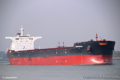
 HERMINA
Current Status
Where is the vessel?
HERMINA is currently in 94 nm SE of Taytay Sandoval, based on AIS data received about 14h ago.
Latest AIS update:
Current position: 9.47833° N, 120.33167° E (94 nm SE of Taytay Sandoval)
Average speed (last 7 days): Loading…
Average speed (last 30 days): Loading…
Vessel profile: HERMINA is a Bulk Carrier with dimensions m x m.
This page combines live AIS, route history, probable destination signals, nearby traffic, and port activity for practical vessel monitoring.
The current position of vessel HERMINA is 9.47833 lat / 120.33167 lng. Updated: 2026-06-29 22:13:19 UTCNearest reference points:
- 35 nm SE of Brookes Point, Palawan
- Near Iloilo
- 21 nm NW of Zamboanga
Currently sailing under the flag of Marshall Islands ![]()
Details:
Live Vessel HERMINA Analytics (details, animations, etc.)
Recent AIS points (UTC):
2026-06-29 19:37:20 UTC · 8.96333, 120.29833 · SOG 11 kn · COG -1°2026-06-29 20:10:19 UTC · 9.07333, 120.30667 · SOG 11 kn · COG -1°
2026-06-29 22:10:18 UTC · 9.46833, 120.33167 · SOG 11 kn · COG -1°
2026-06-29 22:13:19 UTC · 9.47833, 120.33167 · SOG 11 kn · COG -1°