 vesseltracker.com
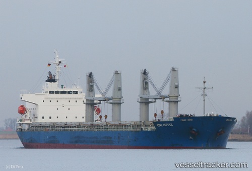
 KING M
Current Status
Where is the vessel?
KING M is currently in 48 nm SE of Masirah, based on AIS data received about 1h ago.
Latest AIS update:
Current position: 20.01167° N, 59.57167° E (48 nm SE of Masirah)
Average speed (last 7 days): Loading…
Average speed (last 30 days): Loading…
Vessel profile: KING M is a General Cargo Ship with dimensions 28m x 182m.
This page combines live AIS, route history, probable destination signals, nearby traffic, and port activity for practical vessel monitoring.
The current position of vessel KING M is 20.01167 lat / 59.57167 lng. Updated: 2026-05-13 19:50:44 UTCNearest reference points:
- Near AL DUQM
- Near Duqm
- 90 nm SE of SUR
Currently sailing under the flag of Panama ![]()
KING M built in 2012 year
Deadweight:
32809 tDetails:
Live Vessel KING M Analytics (details, animations, etc.)
Recent AIS points (UTC):
2026-05-13 16:44:40 UTC · 19.44833, 59.19333 · SOG 12 kn · COG -1°2026-05-13 18:25:33 UTC · 19.75484, 59.39364 · SOG 12.9 kn · COG 34°
2026-05-13 19:44:42 UTC · 19.99333, 59.55833 · SOG 12 kn · COG -1°
2026-05-13 19:50:44 UTC · 20.01167, 59.57167 · SOG 12 kn · COG -1°