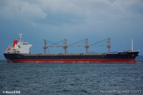
Dianthus
Current StatusWhere is the vessel?
Dianthus is currently in 54 nm S of OMAEZAKI, based on AIS data received about 14h ago.
Latest AIS update:
Current position: 33.76996° N, 137.88464° E (54 nm S of OMAEZAKI)
Average speed (last 7 days): Loading…
Average speed (last 30 days): Loading…
Vessel profile: Dianthus is a Bulk Carrier with dimensions 27m x 170m.
This page combines live AIS, route history, probable destination signals, nearby traffic, and port activity for practical vessel monitoring.
The current position of vessel Dianthus is 33.76996 lat / 137.88464 lng. Updated: 2026-05-22 09:22:25 UTCNearest reference points:
- 17 nm SW of OMAEZAKI
- 17 nm S of TOYOHASHI
- Near OMAEZAKI
Details:
Live Vessel Dianthus Analytics (details, animations, etc.)
Recent AIS points (UTC):
2026-05-22 06:23:14 UTC · 33.84647, 138.00044 · SOG 4.9 kn · COG -1°2026-05-22 07:08:44 UTC · 33.82453, 137.96715 · SOG 3.5 kn · COG 158°
2026-05-22 07:27:17 UTC · 33.81656, 137.95441 · SOG 2.6 kn · COG 167°
2026-05-22 09:22:25 UTC · 33.76996, 137.88464 · SOG 2.8 kn · COG 174°