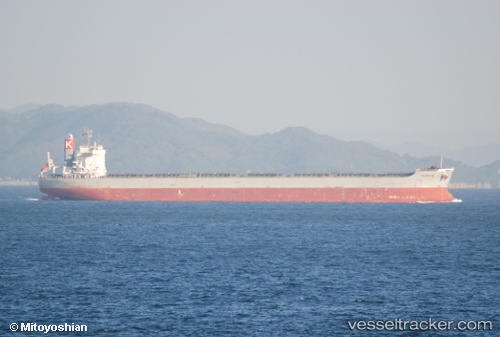
Sargam
Current StatusWhere is the vessel?
Sargam is currently in Near EAST ARNHEM, based on AIS data received about 14h ago.
Latest AIS update:
Current position: 12.20589° S, 136.66962° E (Near EAST ARNHEM)
Average speed (last 7 days): Loading…
Average speed (last 30 days): Loading…
Vessel profile: Sargam is a Bulk Carrier with dimensions 38m x 235m.
This page combines live AIS, route history, probable destination signals, nearby traffic, and port activity for practical vessel monitoring.
The current position of vessel Sargam is -12.20589 lat / 136.66962 lng. Updated: 2026-05-19 21:21:02 UTCNearest reference points:
- 28 nm N of Elizabeth Bay
- 137 nm N of Elizabeth Bay
Details:
Live Vessel Sargam Analytics (details, animations, etc.)
Recent AIS points (UTC):
2026-05-19 17:33:25 UTC · -12.20585, 136.66963 · SOG 0 kn · COG -1°2026-05-19 19:32:52 UTC · -12.20587, 136.66960 · SOG 0 kn · COG -1°
2026-05-19 19:59:24 UTC · -12.20593, 136.66960 · SOG 0 kn · COG -1°
2026-05-19 21:21:02 UTC · -12.20589, 136.66962 · SOG 0 kn · COG -1°