 Balsa 89
Current Status
Where is the vessel?
Balsa 89 is currently in Near Kingston, based on AIS data received about 15h ago.
Latest AIS update:
Current position: 17.95866° N, 76.78158° W (Near Kingston)
Average speed (last 7 days): Loading…
Average speed (last 30 days): Loading…
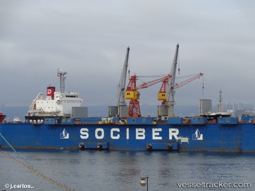
Vessel profile: Balsa 89 is a General Cargo Ship with dimensions 106m x 19m.
This page combines live AIS, route history, probable destination signals, nearby traffic, and port activity for practical vessel monitoring.
The current position of vessel Balsa 89 is 17.95866 lat / -76.78158 lng. Updated: 2026-06-11 22:02:03 UTCNearest reference points:
- 16 nm SE of Ceiba Hueca
Currently sailing under the flag of Panama ![]()
Balsa 89 built in 2013 year
Deadweight:
7760 tDetails:
Live Vessel Balsa 89 Analytics (details, animations, etc.)
Recent AIS points (UTC):
2026-06-11 19:21:46 UTC · 17.95865, -76.78154 · SOG 0.1 kn · COG 128°2026-06-11 19:21:46 UTC · 17.95865, -76.78154 · SOG 0.1 kn · COG 128°
2026-06-11 21:57:46 UTC · 17.95863, -76.78164 · SOG 0 kn · COG 122°
2026-06-11 22:02:03 UTC · 17.95866, -76.78158 · SOG 0.1 kn · COG -1°