 VALENTINA
Current Status
Where is the vessel?
VALENTINA is currently in 48 nm SE of Barra de Santo Antonio, based on AIS data received about 14h ago.
Latest AIS update:
Current position: 10.00507° S, 34.96104° W (48 nm SE of Barra de Santo Antonio)
Average speed (last 7 days): Loading…
Average speed (last 30 days): Loading…
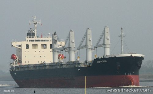
Vessel profile: VALENTINA is a General Cargo Ship with dimensions 180m x 180m.
This page combines live AIS, route history, probable destination signals, nearby traffic, and port activity for practical vessel monitoring.
The current position of vessel VALENTINA is -10.00507 lat / -34.96104 lng. Updated: 2026-05-21 07:21:11 UTCNearest reference points:
- Near Suape
- 157 nm SE of Maceio
- Near Boa Viagem
Currently sailing under the flag of Liberia ![]()
VALENTINA built in 2013 year
Deadweight:
33382 tDetails:
Live Vessel VALENTINA Analytics (details, animations, etc.)
Recent AIS points (UTC):
2026-05-21 04:24:12 UTC · -10.54041, -35.21085 · SOG 11.7 kn · COG 27°2026-05-21 05:05:31 UTC · -10.41712, -35.15359 · SOG 11.8 kn · COG 27°
2026-05-21 06:02:15 UTC · -10.24738, -35.07202 · SOG 12.1 kn · COG 26°
2026-05-21 07:21:11 UTC · -10.00507, -34.96104 · SOG 12.1 kn · COG 28°