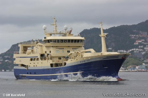
 Eros
Eros
Current Status
Where is the vessel?
Eros is currently in 69 nm N of Urd, based on AIS data received about 14h ago.
Latest AIS update:
Current position: 67.16504° N, 8.90401° E (69 nm N of Urd)
Average speed (last 7 days): Loading…
Average speed (last 30 days): Loading…
Vessel profile: Eros is a Fish Carrier with dimensions 77m x 16m.
This page combines live AIS, route history, probable destination signals, nearby traffic, and port activity for practical vessel monitoring.
The current position of vessel Eros is 67.16504 lat / 8.90401 lng. Updated: 2026-07-08 09:17:21 UTCNearest reference points:
- 35 nm E of Urd
Currently sailing under the flag of Norway ![]()
Eros built in 2012 year
Deadweight:
3000 tDetails:
Live Vessel Eros Analytics (details, animations, etc.)
Recent AIS points (UTC):
2026-07-08 06:37:12 UTC · 67.19686, 8.47425 · SOG 10.7 kn · COG 97°2026-07-08 07:16:32 UTC · 67.18005, 8.75873 · SOG 10 kn · COG 94°
2026-07-08 07:26:45 UTC · 67.17590, 8.83188 · SOG 10.5 kn · COG 94°
2026-07-08 09:17:21 UTC · 67.16504, 8.90401 · SOG 2.4 kn · COG 257°