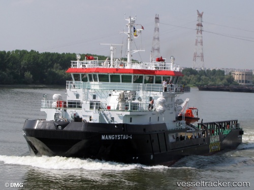
Mangystau 4
Current StatusWhere is the vessel?
Mangystau 4 is currently in 24 nm E of Majsperk, based on AIS data received about 18d ago.
Latest AIS update:
Current position: 46.41891° N, 52.29418° E (24 nm E of Majsperk)
Average speed (last 7 days): Loading…
Average speed (last 30 days): Loading…
Vessel profile: Mangystau 4 is a Tug with dimensions 17m x 66m.
This page combines live AIS, route history, probable destination signals, nearby traffic, and port activity for practical vessel monitoring.
The current position of vessel Mangystau 4 is 46.41891 lat / 52.29418 lng. Updated: 2026-05-04 09:34:49 UTCNearest reference points:
- 23 nm E of Majsperk
- 64 nm NE of Majsperk
Details:
Live Vessel Mangystau 4 Analytics (details, animations, etc.)
Recent AIS points (UTC):
2026-05-04 09:34:49 UTC · 46.41891, 52.29418 · SOG 0.5 kn · COG 294°