 vesseltracker.com
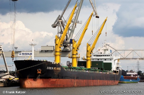
 SIDER ATLANTIC
Current Status
Where is the vessel?
SIDER ATLANTIC is currently in 21 nm SW of VLYCHADA, based on AIS data received less than 1h ago.
Latest AIS update:
Current position: 36.09577° N, 25.13295° E (21 nm SW of VLYCHADA)
Average speed (last 7 days): Loading…
Average speed (last 30 days): Loading…
Vessel profile: SIDER ATLANTIC is a General Cargo Ship with dimensions 157m x 25m.
This page combines live AIS, route history, probable destination signals, nearby traffic, and port activity for practical vessel monitoring.
The current position of vessel SIDER ATLANTIC is 36.09577 lat / 25.13295 lng. Updated: 2026-05-16 07:34:51 UTCNearest reference points:
- Near Iraklion
- Near PISO LIVADI
- Near Delos
Currently sailing under the flag of Portugal (MAR) ![]()
SIDER ATLANTIC built in 2011 year
Deadweight:
25469 tDetails:
Live Vessel SIDER ATLANTIC Analytics (details, animations, etc.)
Recent AIS points (UTC):
2026-05-16 03:37:31 UTC · 36.06725, 24.30017 · SOG 10.3 kn · COG 89°2026-05-16 04:14:51 UTC · 36.06931, 24.43469 · SOG 10.5 kn · COG 88°
2026-05-16 05:47:41 UTC · 36.08116, 24.77160 · SOG 10.1 kn · COG 88°
2026-05-16 07:34:51 UTC · 36.09577, 25.13295 · SOG 9.5 kn · COG 90°