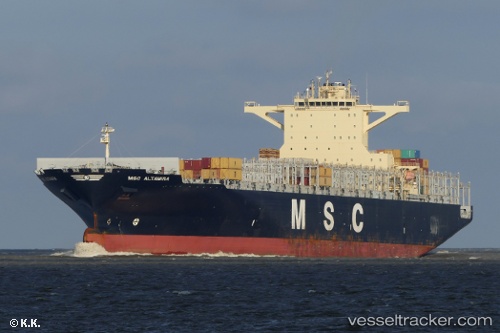
 Msc Altamira
Current Status
Where is the vessel?
Msc Altamira is currently in 74 nm W of Geraldton, based on AIS data received about 14h ago.
Latest AIS update:
Current position: 28.35632° S, 113.25699° E (74 nm W of Geraldton)
Average speed (last 7 days): Loading…
Average speed (last 30 days): Loading…
Vessel profile: Msc Altamira is a Container Ship with dimensions 299m x 48m.
This page combines live AIS, route history, probable destination signals, nearby traffic, and port activity for practical vessel monitoring.
The current position of vessel Msc Altamira is -28.35632 lat / 113.25699 lng. Updated: 2026-05-20 13:10:39 UTCCurrently sailing under the flag of Liberia ![]()
Msc Altamira built in 2012 year
Deadweight:
112516 tDetails:
Live Vessel Msc Altamira Analytics (details, animations, etc.)
Recent AIS points (UTC):
2026-05-20 09:47:40 UTC · -29.28682, 113.74308 · SOG 18 kn · COG 333°2026-05-20 10:45:03 UTC · -29.03258, 113.59614 · SOG 17.6 kn · COG 330°
2026-05-20 12:11:04 UTC · -28.65090, 113.38004 · SOG 18 kn · COG 334°
2026-05-20 13:10:39 UTC · -28.35632, 113.25699 · SOG 19.5 kn · COG 346°