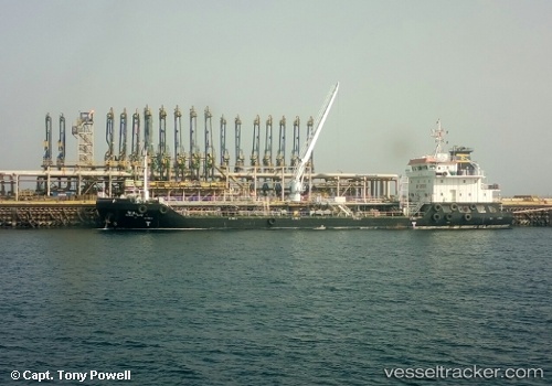
Dia
Current StatusWhere is the vessel?
Dia is currently in 19 nm NE of Ras Al-Khair, based on AIS data received about 14h ago.
Latest AIS update:
Current position: 27.70876° N, 49.50153° E (19 nm NE of Ras Al-Khair)
Average speed (last 7 days): Loading…
Average speed (last 30 days): Loading…
Vessel profile: Dia is a Oil Products Tanker with dimensions 16m x 80m.
This page combines live AIS, route history, probable destination signals, nearby traffic, and port activity for practical vessel monitoring.
The current position of vessel Dia is 27.70876 lat / 49.50153 lng. Updated: 2026-07-09 05:55:09 UTCNearest reference points:
- Near Ras Al Khair
- Near Ras Al-Khair
- 41 nm NE of Ras Al Khair
Details:
Live Vessel Dia Analytics (details, animations, etc.)
Recent AIS points (UTC):
2026-07-09 02:50:58 UTC · 27.70864, 49.50131 · SOG 0.3 kn · COG 333°2026-07-09 03:49:09 UTC · 27.70868, 49.50137 · SOG 0 kn · COG 331°
2026-07-09 05:01:06 UTC · 27.70870, 49.50142 · SOG 0 kn · COG 330°
2026-07-09 05:55:09 UTC · 27.70876, 49.50153 · SOG 0 kn · COG 325°