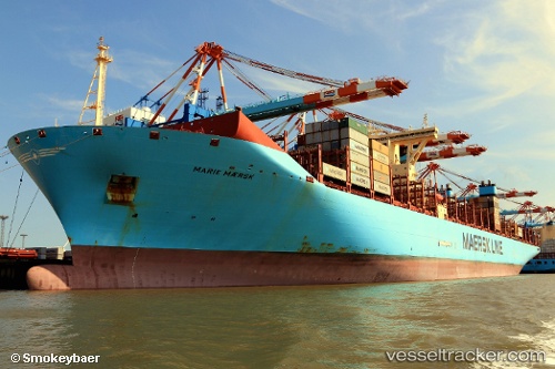
 Marie Maersk
Current Status
Where is the vessel?
Marie Maersk is currently in 344 nm S of Harper, based on AIS data received about 14h ago.
Latest AIS update:
Current position: 1.14755° S, 9.29837° W (344 nm S of Harper)
Average speed (last 7 days): Loading…
Average speed (last 30 days): Loading…
Vessel profile: Marie Maersk is a Container Ship with dimensions 399m x 399m.
This page combines live AIS, route history, probable destination signals, nearby traffic, and port activity for practical vessel monitoring.
The current position of vessel Marie Maersk is -1.14755 lat / -9.29837 lng. Updated: 2026-06-12 00:21:52 UTCNearest reference points:
- Open sea, approx. 401 nm off the nearest listed port
- Open sea, approx. 402 nm off the nearest listed port
- Open sea, approx. 404 nm off the nearest listed port
Currently sailing under the flag of Denmark ![]()
Marie Maersk built in 2013 year
Deadweight:
194327 tDetails:
Live Vessel Marie Maersk Analytics (details, animations, etc.)
Recent AIS points (UTC):
2026-06-11 20:04:51 UTC · -2.18528, -8.57653 · SOG 17.6 kn · COG 329°2026-06-11 22:03:17 UTC · -1.70908, -8.90777 · SOG 17.6 kn · COG 328°
2026-06-11 22:47:52 UTC · -1.52843, -9.03336 · SOG 17.8 kn · COG 328°
2026-06-12 00:21:52 UTC · -1.14755, -9.29837 · SOG 17.7 kn · COG 329°