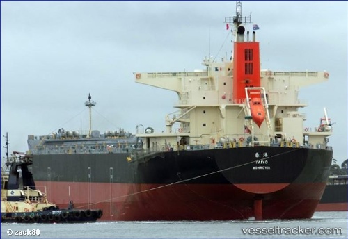
 Taiyo
Taiyo
Current Status
Where is the vessel?
Taiyo is currently in Near Tsugaru-Kaikyo, based on AIS data received about 14h ago.
Latest AIS update:
Current position: 41.49494° N, 140.59865° E (Near Tsugaru-Kaikyo)
Average speed (last 7 days): Loading…
Average speed (last 30 days): Loading…
Vessel profile: Taiyo is a Bulk Carrier with dimensions 235m x 38m.
This page combines live AIS, route history, probable destination signals, nearby traffic, and port activity for practical vessel monitoring.
The current position of vessel Taiyo is 41.49494 lat / 140.59865 lng. Updated: 2026-05-20 17:58:52 UTCNearest reference points:
- 11 nm NW of Yokohama, Aomori
- 23 nm NE of SAI
- Near Yokohama, Aomori
Currently sailing under the flag of Liberia ![]()
Details:
Live Vessel Taiyo Analytics (details, animations, etc.)
Recent AIS points (UTC):
2026-05-20 14:04:48 UTC · 41.60263, 141.26752 · SOG 9 kn · COG 276°2026-05-20 15:25:22 UTC · 41.63949, 140.98906 · SOG 7.9 kn · COG 285°
2026-05-20 16:09:31 UTC · 41.64824, 140.84697 · SOG 6.1 kn · COG 238°
2026-05-20 17:58:52 UTC · 41.49494, 140.59865 · SOG 9.8 kn · COG 244°