 MEGHNA FREEDOM
Current Status
Where is the vessel?
MEGHNA FREEDOM is currently in 387 nm N of Aquiraz, based on AIS data received about 14h ago.
Latest AIS update:
Current position: 2.28600° N, 30.23980° W (387 nm N of Aquiraz)
Average speed (last 7 days): Loading…
Average speed (last 30 days): Loading…
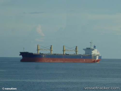
Vessel profile: MEGHNA FREEDOM is a Bulk Carrier with dimensions 190m x 32m.
This page combines live AIS, route history, probable destination signals, nearby traffic, and port activity for practical vessel monitoring.
The current position of vessel MEGHNA FREEDOM is 2.28600 lat / -30.23980 lng. Updated: 2026-06-11 23:37:36 UTCNearest reference points:
- Open sea, approx. 402 nm off the nearest listed port
- Open sea, approx. 403 nm off the nearest listed port
- Open sea, approx. 405 nm off the nearest listed port
Currently sailing under the flag of Bangladesh ![]()
MEGHNA FREEDOM built in 2013 year
Deadweight:
56088 tDetails:
Live Vessel MEGHNA FREEDOM Analytics (details, animations, etc.)
Recent AIS points (UTC):
2026-06-11 19:57:16 UTC · 2.85195, -30.06913 · SOG 9.2 kn · COG 188°2026-06-11 21:21:17 UTC · 2.63930, -30.13114 · SOG 9.7 kn · COG 188°
2026-06-11 22:31:45 UTC · 2.45674, -30.18466 · SOG 9.8 kn · COG 188°
2026-06-11 23:37:36 UTC · 2.28600, -30.23980 · SOG 9.7 kn · COG 188°