 Nordlotus
Current Status
Where is the vessel?
Nordlotus is currently in Near Nida, based on AIS data received about 14h ago.
Latest AIS update:
Current position: 56.04436° N, 20.95800° E (Near Nida)
Average speed (last 7 days): Loading…
Average speed (last 30 days): Loading…
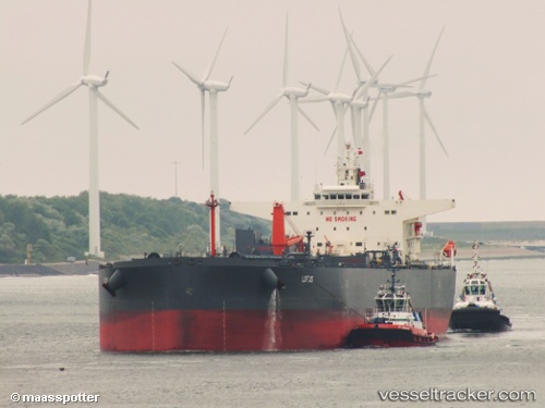
Vessel profile: Nordlotus is a Crude Oil Tanker with dimensions 229m x 42m.
This page combines live AIS, route history, probable destination signals, nearby traffic, and port activity for practical vessel monitoring.
The current position of vessel Nordlotus is 56.04436 lat / 20.95800 lng. Updated: 2026-05-21 07:20:04 UTCNearest reference points:
- Near Klaipeda
- Near Cimdenieki
- 39 nm W of Pilies juru uosto PVP/Klaipeda
Currently sailing under the flag of Portugal ![]()
Nordlotus built in 2013 year
Deadweight:
104280 tDetails:
Live Vessel Nordlotus Analytics (details, animations, etc.)
Recent AIS points (UTC):
2026-05-21 03:47:04 UTC · 56.04537, 20.95627 · SOG 0 kn · COG 61°2026-05-21 04:29:04 UTC · 56.04647, 20.95584 · SOG 0 kn · COG 90°
2026-05-21 05:14:04 UTC · 56.04734, 20.95611 · SOG 0 kn · COG 111°
2026-05-21 07:20:04 UTC · 56.04436, 20.95800 · SOG 0 kn · COG 32°