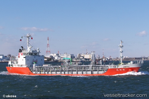
Yoyu Maru
Current StatusWhere is the vessel?
Yoyu Maru is currently in Near FUKUYAMA, based on AIS data received about 15h ago.
Latest AIS update:
Current position: 34.38595° N, 133.43620° E (Near FUKUYAMA)
Average speed (last 7 days): Loading…
Average speed (last 30 days): Loading…
Vessel profile: Yoyu Maru is a Chemical Oil Products Tanker with dimensions 10m x 65m.
This page combines live AIS, route history, probable destination signals, nearby traffic, and port activity for practical vessel monitoring.
The current position of vessel Yoyu Maru is 34.38595 lat / 133.43620 lng. Updated: 2026-05-20 05:27:27 UTCNearest reference points:
- Near FUKUYAMA
- Near MIZUSHIMA
- Near ONOMICHIITOZAKI
Details:
Live Vessel Yoyu Maru Analytics (details, animations, etc.)
Recent AIS points (UTC):
2026-05-20 01:47:08 UTC · 34.07760, 132.84190 · SOG 11.1 kn · COG 9°2026-05-20 03:35:51 UTC · 34.34495, 133.08490 · SOG 11.6 kn · COG 22°
2026-05-20 04:14:10 UTC · 34.34629, 133.19797 · SOG 10.9 kn · COG 129°
2026-05-20 05:27:27 UTC · 34.38595, 133.43620 · SOG 10.6 kn · COG 55°