 Nordpuma
Current Status
Where is the vessel?
Nordpuma is currently in 47 nm W of Sociedad Portuaria Regional Cartagena, based on AIS data received about 15h ago.
Latest AIS update:
Current position: 10.29333° N, 76.32167° W (47 nm W of Sociedad Portuaria Regional Cartagena)
Average speed (last 7 days): Loading…
Average speed (last 30 days): Loading…
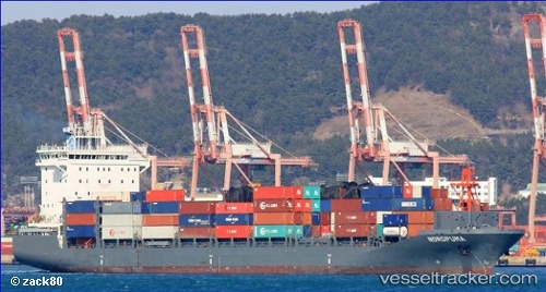
Vessel profile: Nordpuma is a Container Ship with dimensions 170m x 28m.
This page combines live AIS, route history, probable destination signals, nearby traffic, and port activity for practical vessel monitoring.
The current position of vessel Nordpuma is 10.29333 lat / -76.32167 lng. Updated: 2026-05-20 14:00:34 UTCNearest reference points:
- Near Sociedad Portuaria Regional Cartagena
- Near Contecar
- 62 nm NE of Playón Chico
Currently sailing under the flag of Cyprus ![]()
Details:
Live Vessel Nordpuma Analytics (details, animations, etc.)
Recent AIS points (UTC):
2026-05-20 10:22:05 UTC · 10.31389, -75.63061 · SOG 11 kn · COG 265°2026-05-20 12:20:37 UTC · 10.30415, -76.00559 · SOG 11.2 kn · COG 266°
2026-05-20 13:30:43 UTC · 10.29675, -76.22929 · SOG 11.2 kn · COG 265°
2026-05-20 14:00:34 UTC · 10.29333, -76.32167 · SOG 10 kn · COG -1°