 LIMA STRAIT
Current Status
Where is the vessel?
LIMA STRAIT is currently in Near NEMRUT, based on AIS data received about 15h ago.
Latest AIS update:
Current position: 38.75935° N, 26.92454° E (Near NEMRUT)
Average speed (last 7 days): Loading…
Average speed (last 30 days): Loading…
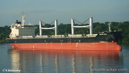
Vessel profile: LIMA STRAIT is a Bulk Carrier with dimensions 186m x 28m.
This page combines live AIS, route history, probable destination signals, nearby traffic, and port activity for practical vessel monitoring.
The current position of vessel LIMA STRAIT is 38.75935 lat / 26.92454 lng. Updated: 2026-05-21 05:19:23 UTCNearest reference points:
- Near NEMRUT
- Near Nemrut Bay
- Near Aliaga
Currently sailing under the flag of Liberia ![]()
LIMA STRAIT built in 2012 year
Deadweight:
37187 tDetails:
Live Vessel LIMA STRAIT Analytics (details, animations, etc.)
Recent AIS points (UTC):
2026-05-21 02:01:24 UTC · 38.75934, 26.92457 · SOG 0 kn · COG 161°2026-05-21 03:52:23 UTC · 38.75935, 26.92453 · SOG 0 kn · COG 161°
2026-05-21 04:34:21 UTC · 38.75939, 26.92454 · SOG 0 kn · COG 161°
2026-05-21 05:19:23 UTC · 38.75935, 26.92454 · SOG 0 kn · COG 161°