Ruby
Current StatusWhere is the vessel?
Ruby is currently in 14 nm E of Il-Kappara, based on AIS data received about 16h ago.
Latest AIS update:
Current position: 35.91924° N, 14.84476° E (14 nm E of Il-Kappara)
Average speed (last 7 days): Loading…
Average speed (last 30 days): Loading…
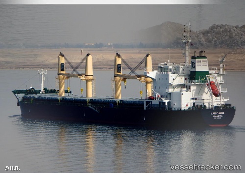
Vessel profile: Ruby is a General Cargo Ship with dimensions 28m x 183m.
This page combines live AIS, route history, probable destination signals, nearby traffic, and port activity for practical vessel monitoring.
The current position of vessel Ruby is 35.91924 lat / 14.84476 lng. Updated: 2026-05-20 13:51:37 UTCNearest reference points:
- 13 nm E of Il-Kappara
- 18 nm E of Il-Kappara
- Near Xghajra
Details:
Live Vessel Ruby Analytics (details, animations, etc.)
Recent AIS points (UTC):
2026-05-20 10:26:27 UTC · 35.76890, 15.53921 · SOG 11.6 kn · COG 281°2026-05-20 11:48:57 UTC · 35.81851, 15.21740 · SOG 11.6 kn · COG 285°
2026-05-20 13:26:08 UTC · 35.90823, 14.86520 · SOG 6.6 kn · COG 308°
2026-05-20 13:51:37 UTC · 35.91924, 14.84476 · SOG 0.4 kn · COG 13°