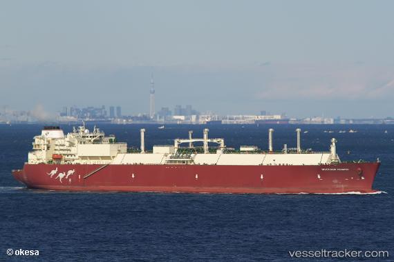
Woodside Rogers
Current StatusWhere is the vessel?
Woodside Rogers is currently in 53 nm W of Labuha, Molucas, based on AIS data received about 14h ago.
Latest AIS update:
Current position: 0.66172° S, 126.60959° E (53 nm W of Labuha, Molucas)
Average speed (last 7 days): Loading…
Average speed (last 30 days): Loading…
Vessel profile: Woodside Rogers is a Lng Tanker with dimensions 44m x 294m.
This page combines live AIS, route history, probable destination signals, nearby traffic, and port activity for practical vessel monitoring.
The current position of vessel Woodside Rogers is -0.66172 lat / 126.60959 lng. Updated: 2026-05-21 01:14:31 UTCNearest reference points:
- 55 nm S of Labuha, Molucas
- 69 nm NW of Wainibe
- Near TERNATE
Details:
Live Vessel Woodside Rogers Analytics (details, animations, etc.)
Recent AIS points (UTC):
2026-05-20 22:43:06 UTC · -1.43833, 126.74227 · SOG 20.7 kn · COG 1°2026-05-20 23:18:22 UTC · -1.24156, 126.70512 · SOG 20.1 kn · COG 346°
2026-05-21 01:14:31 UTC · -0.66172, 126.60959 · SOG 18.5 kn · COG 355°
2026-05-21 01:14:31 UTC · -0.66172, 126.60959 · SOG 18.5 kn · COG 355°