 vesseltracker.com
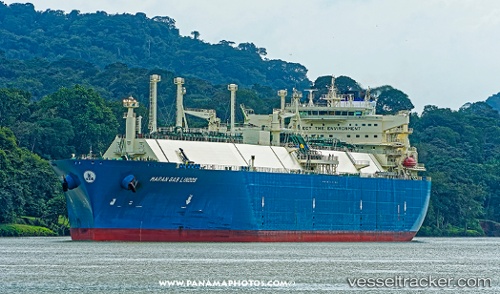
 Maran Gas Lindos
Current Status
Where is the vessel?
Maran Gas Lindos is currently in 118 nm SE of Saga, based on AIS data received less than 1h ago.
Latest AIS update:
Current position: 31.28264° N, 134.01955° E (118 nm SE of Saga)
Average speed (last 7 days): Loading…
Average speed (last 30 days): Loading…
Vessel profile: Maran Gas Lindos is a Lng Tanker with dimensions 294m x 44m.
This page combines live AIS, route history, probable destination signals, nearby traffic, and port activity for practical vessel monitoring.
The current position of vessel Maran Gas Lindos is 31.28264 lat / 134.01955 lng. Updated: 2026-05-14 07:43:02 UTCNearest reference points:
- 77 nm S of Sukumowan
- 190 nm E of NISHINOOMOTE
- 19 nm SW of Sukumowan
Currently sailing under the flag of Greece ![]()
Details:
Live Vessel Maran Gas Lindos Analytics (details, animations, etc.)
Recent AIS points (UTC):
2026-05-14 01:42:08 UTC · 32.23123, 135.91525 · SOG 17.7 kn · COG 238°2026-05-14 06:20:14 UTC · 31.50905, 134.46645 · SOG 19.7 kn · COG 236°
2026-05-14 07:36:38 UTC · 31.29978, 134.05351 · SOG 19 kn · COG 237°
2026-05-14 07:43:02 UTC · 31.28264, 134.01955 · SOG 19 kn · COG 237°