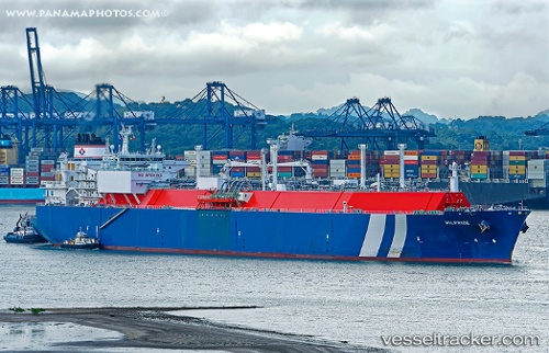
 WILPRIDE
Current Status
Where is the vessel?
WILPRIDE is currently in 268 nm SE of Tarpon Springs, based on AIS data received about 14h ago.
Latest AIS update:
Current position: 25.25911° N, 25.61458° W (268 nm SE of Tarpon Springs)
Average speed (last 7 days): Loading…
Average speed (last 30 days): Loading…
Vessel profile: WILPRIDE is a Lng Tanker with dimensions m x m.
This page combines live AIS, route history, probable destination signals, nearby traffic, and port activity for practical vessel monitoring.
The current position of vessel WILPRIDE is 25.25911 lat / -25.61458 lng. Updated: 2026-05-20 13:21:29 UTCCurrently sailing under the flag of Malta ![]()
Details:
Live Vessel WILPRIDE Analytics (details, animations, etc.)
Recent AIS points (UTC):
2026-05-20 09:48:19 UTC · 26.38338, -25.91421 · SOG 19.6 kn · COG 165°2026-05-20 10:47:23 UTC · 26.07199, -25.83030 · SOG 19.5 kn · COG 168°
2026-05-20 12:14:24 UTC · 25.61473, -25.70810 · SOG 19.4 kn · COG 166°
2026-05-20 13:21:29 UTC · 25.25911, -25.61458 · SOG 19.7 kn · COG 166°