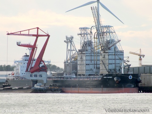
 Union Mariner
Current Status
Where is the vessel?
Union Mariner is currently in 159 nm SE of Akutan, based on AIS data received about 14h ago.
Latest AIS update:
Current position: 51.93166° N, 163.31004° W (159 nm SE of Akutan)
Average speed (last 7 days): Loading…
Average speed (last 30 days): Loading…
Vessel profile: Union Mariner is a vessel with dimensions 229m x 32m.
This page combines live AIS, route history, probable destination signals, nearby traffic, and port activity for practical vessel monitoring.
The current position of vessel Union Mariner is 51.93166 lat / -163.31004 lng. Updated: 2026-05-20 15:39:26 UTCCurrently sailing under the flag of Greece ![]()
Union Mariner built in 2013 year
Deadweight:
81964 tDetails:
Live Vessel Union Mariner Analytics (details, animations, etc.)
Recent AIS points (UTC):
2026-05-20 11:46:35 UTC · 51.82395, -164.56808 · SOG 12.1 kn · COG 83°2026-05-20 13:40:25 UTC · 51.87121, -163.96814 · SOG 12.4 kn · COG 83°
2026-05-20 13:41:56 UTC · 51.87193, -163.95987 · SOG 12.3 kn · COG 83°
2026-05-20 15:39:26 UTC · 51.93166, -163.31004 · SOG 12.3 kn · COG 83°