 vesseltracker.com
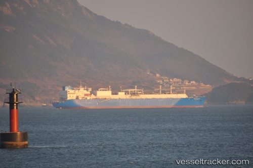
 VALERA
Current Status
Where is the vessel?
VALERA is currently in 132 nm SW of Las Brujas, based on AIS data received about 14h ago.
Latest AIS update:
Current position: 21.91513° N, 19.81419° W (132 nm SW of Las Brujas)
Average speed (last 7 days): Loading…
Average speed (last 30 days): Loading…
Vessel profile: VALERA is a Lng Tanker with dimensions m x m.
This page combines live AIS, route history, probable destination signals, nearby traffic, and port activity for practical vessel monitoring.
The current position of vessel VALERA is 21.91513 lat / -19.81419 lng. Updated: 2026-05-18 05:26:00 UTCNearest reference points:
- 41 nm NW of Nouadhibou
Currently sailing under the flag of Oman ![]()
Details:
Live Vessel VALERA Analytics (details, animations, etc.)
Recent AIS points (UTC):
2026-05-18 01:24:43 UTC · 20.97555, -19.98216 · SOG 14.2 kn · COG 14°2026-05-18 03:58:52 UTC · 21.57900, -19.87115 · SOG 13.8 kn · COG 9°
2026-05-18 04:50:52 UTC · 21.77974, -19.83650 · SOG 14 kn · COG 9°
2026-05-18 05:26:00 UTC · 21.91513, -19.81419 · SOG 13.9 kn · COG 11°